

Eastern Poeloevers Amstelveen
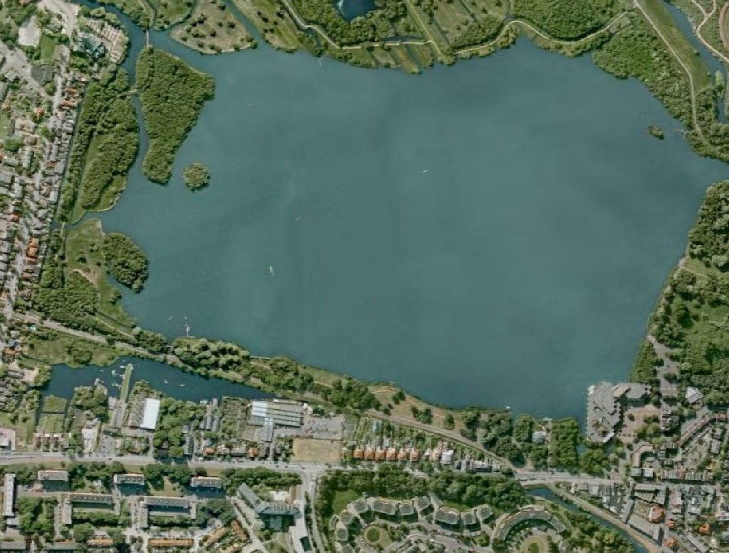
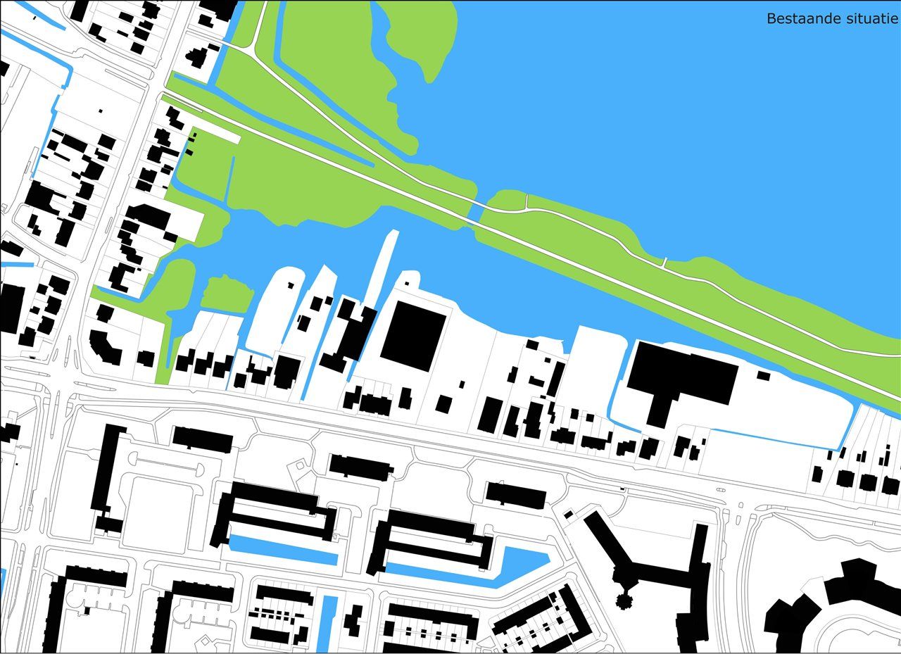
The eastern banks of the Poel in Amstelveen are neglected and sometimes lie fallow. In time, the functions currently present there will disappear. Garden centres, a church, retail outlets and a few water sports clubs will move away, freeing up the land for new uses. The policy document (adopted by the municipality in 2006) assumes that around 60 new homes will be built in the more expensive segment. The area is difficult to redevelop due to its highly fragmented ownership structure. Ir. Jasper de Haan | Architects were commissioned by the Buitenveldert Development Company in 2007, in collaboration with the municipality of Amstelveen, to conduct a study that ultimately resulted in an urban development plan.
STRUCTURE:
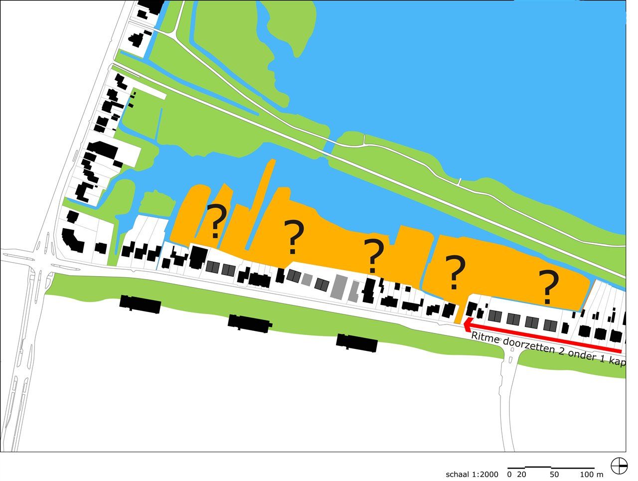
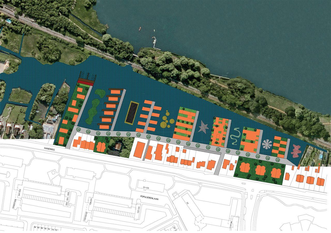
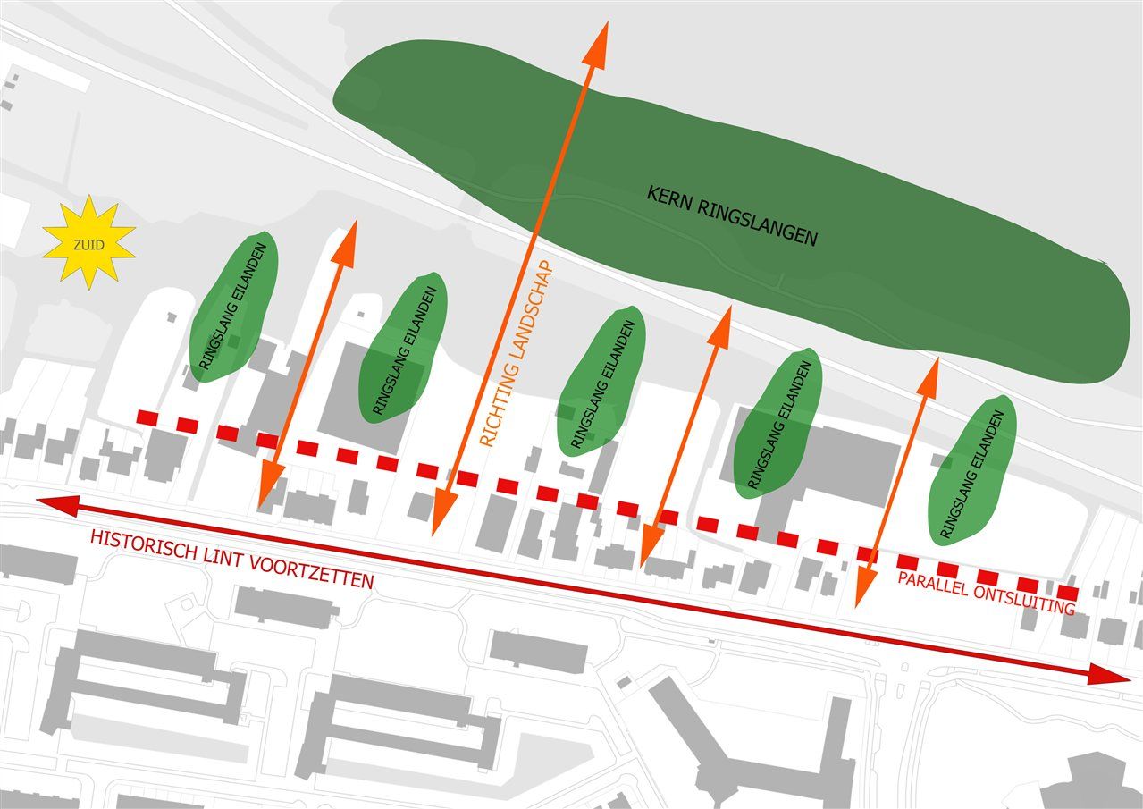
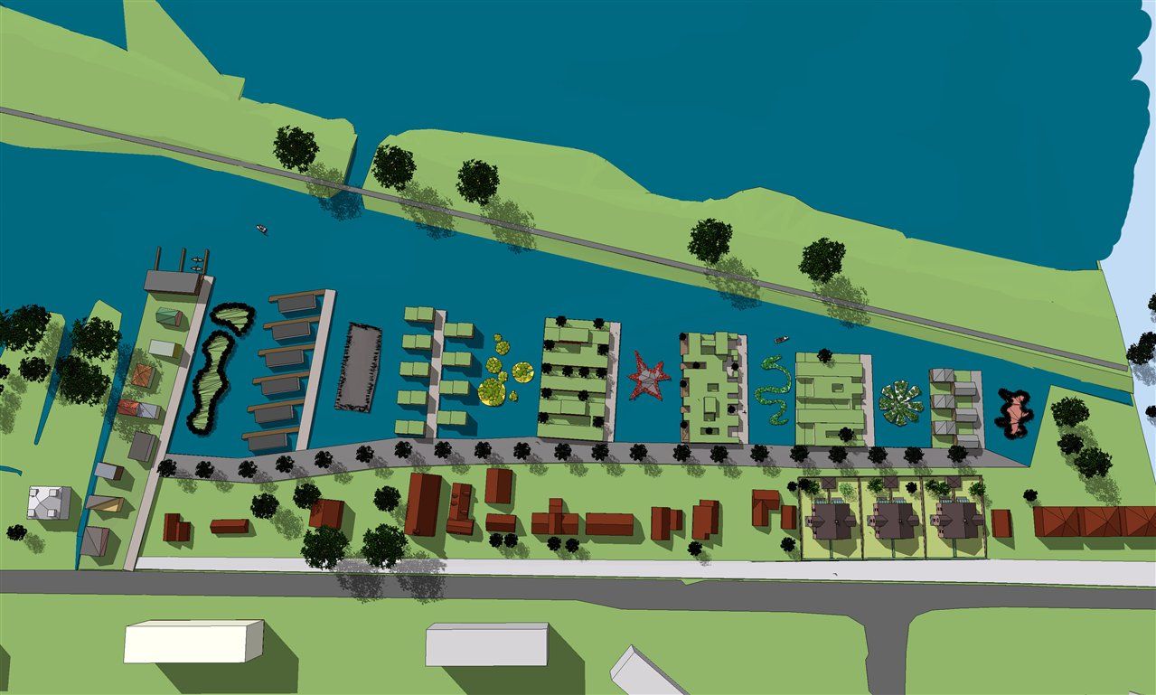
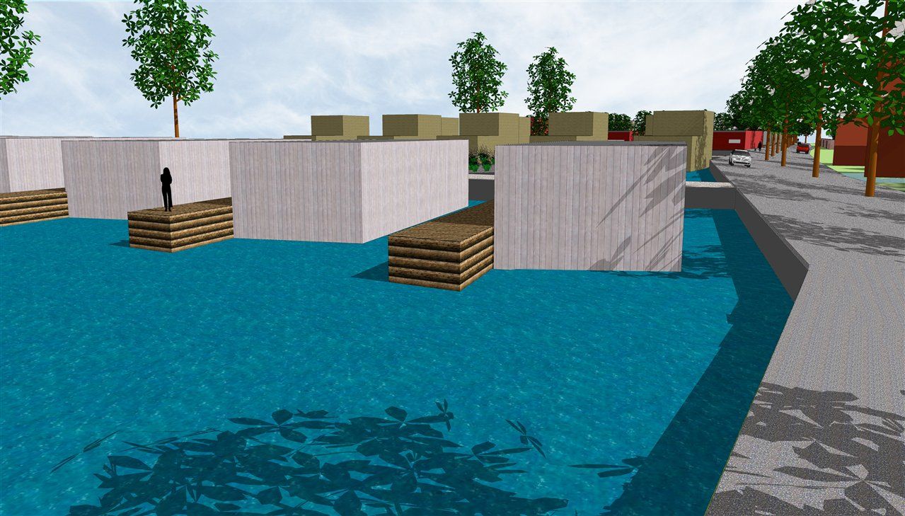
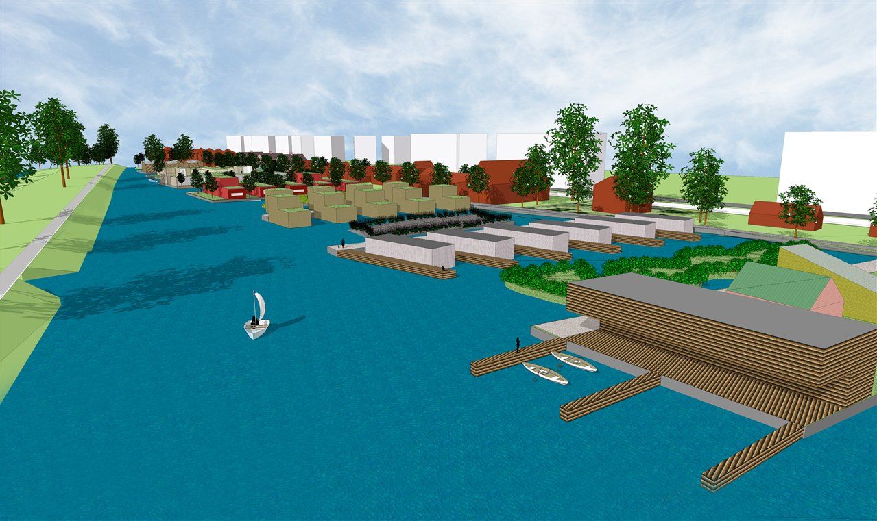
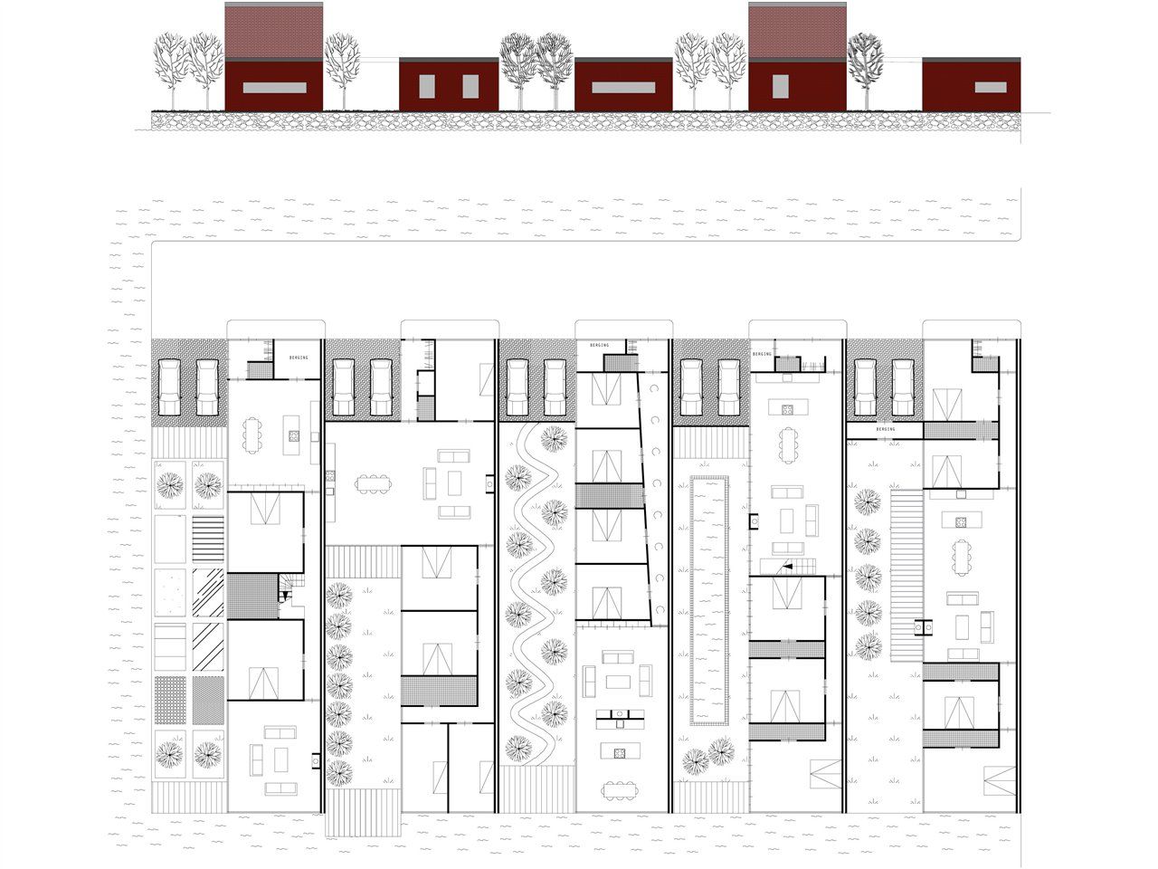
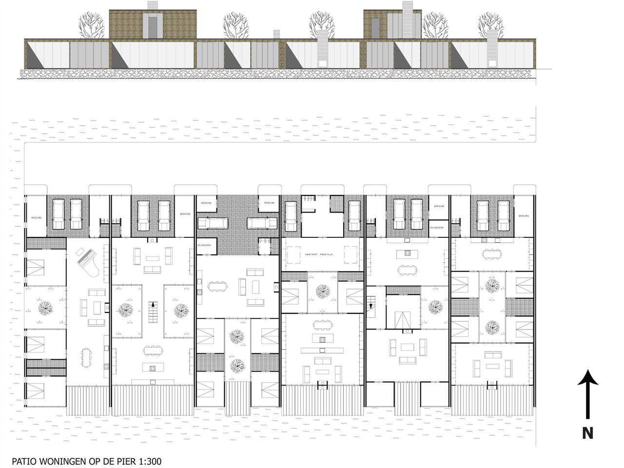
The original structure of the area is characterised by peat dikes and ditches. These run in a south-east to north-west direction. These ditches/plots of land flow into a larger body of water that widens from north to south, because the railway embankment runs increasingly westward in relation to the Handweg in a southerly direction. It is obvious that this original ecological structure of the landscape should be incorporated into new developments. The plan consists of seven built-up piers parallel to that direction, interspersed with open water, with views of the railway embankment and Poel. The piers remain within the line of the original banks, preserving a wide, expansive view of the water to the south from the railway embankment. The width of the water between the piers increases to the south, where the piers also become longer.
Infrastructure:
The Handweg is a busy and important connecting road in Amstelveen. It is desirable that no more entrances and exits are added than currently exist in order to prevent traffic congestion. It is also preferable not to access (new) homes from the Handweg, but from the area behind it. With a semi-paved parallel road (shells), with trees planted in the middle of the road as alternative traffic calming measures and without further road markings, the entire area could be easily accessed. This would eliminate the need for more access and exit roads to the Handweg. In addition, all existing homes would have a rear entrance and there would be the possibility of slightly enlarging the existing gardens. This would also ensure good access for emergency services. Furthermore, the underground infrastructure could be easily and efficiently installed under the semi-paved parallel road.
Ecology:
Grass snakes, a strictly protected species, are found in and around the area.
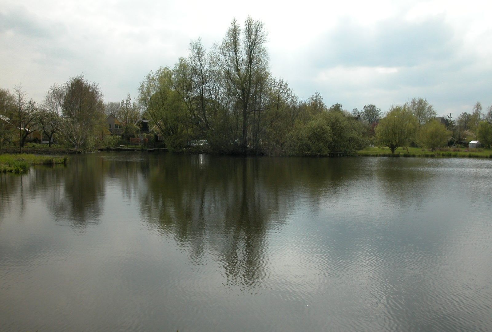
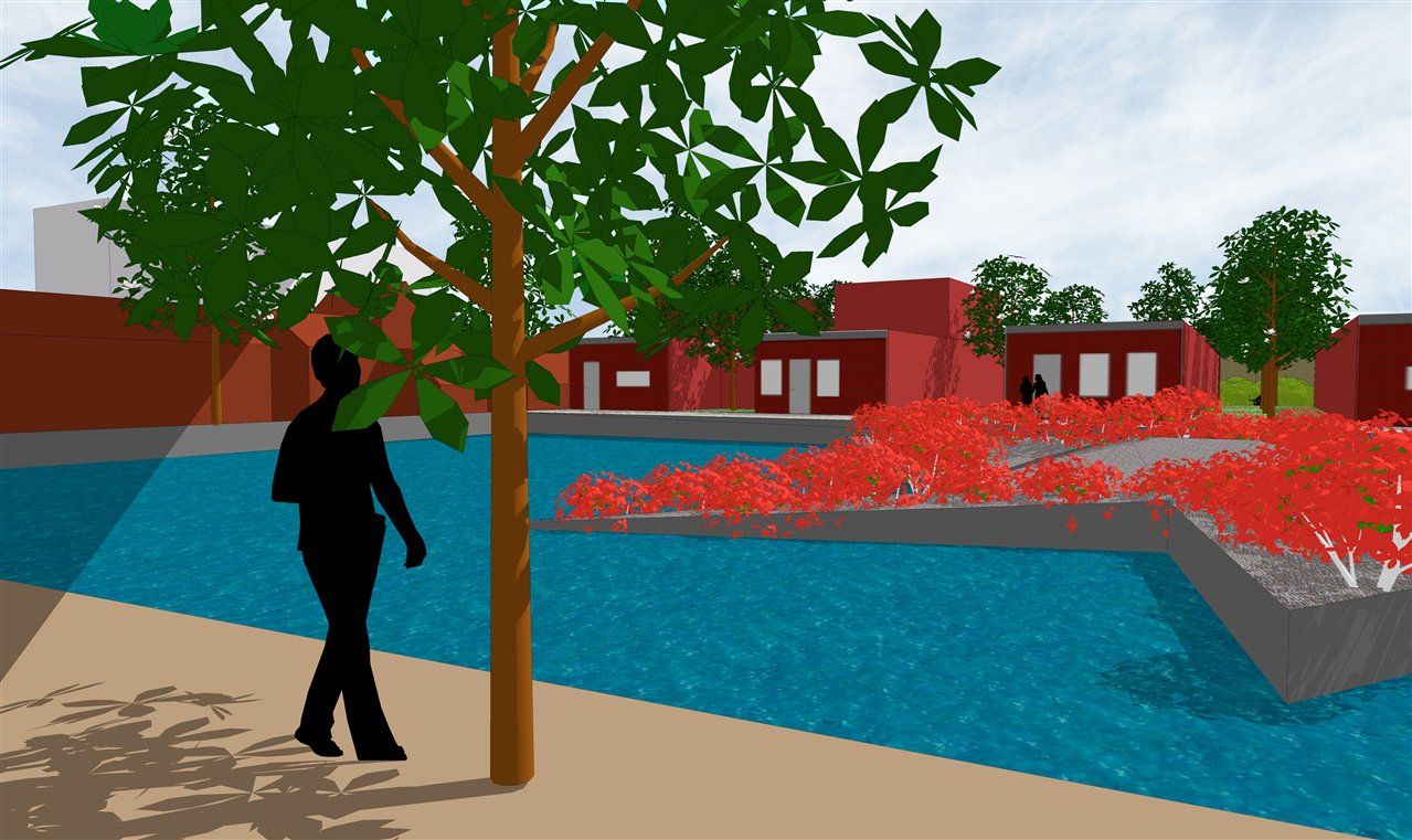
According to Dr A. Zuiderwijk of the University of Amsterdam, the railway embankment is home to the core of the grass snake population of the Poel and Amsterdamse Bos. It is therefore important not to interfere with the railway embankment. However, it would be useful to create more water that serves as a hunting ground and habitat for the grass snake. The plan envisages much more water than is currently available. Between the piers with houses, 'grass snake islands' will be created, with reeds, aquatic plants and shrubs, where the snakes can hunt frogs and other prey. These islands will not be accessible to humans. Sunbathing spots for the grass snakes will also be created on the islands. The water plant islands are also the spawning and egg-laying area for frogs and fish. The banks with the houses and roads are relatively steeply revetmed, so that grass snakes are prevented from migrating towards the centre of Amstelveen. In the evening, these open stretches of water, with their countless mosquitoes, also form the hunting ground for the bats present.
Living:
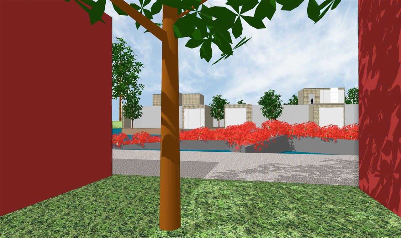
The houses on the piers are accessed from the north side by a road paved with ceramic clinkers. Each house has at least two parking spaces on its own site. The houses are relatively large, 200 to 250 m2. All houses are oriented towards the south and water. The houses are two-storey or single-storey with a roof and thus considerably lower than the houses on Handweg. About half of the houses are single-storey with small gardens/patios, making them particularly suitable for senior citizens.
The open spaces in the historical ribbon will be harmoniously filled with semi-detached houses that fit within the architecture of the ribbon.
The parsonage garden could be retained and then the water with island between piers two and three would turn into a park. Perhaps with a play area for children.
A modest catering/recreation/boat rental function is envisaged at the head of pier one, which could be an important place and identity for this area in summer and in winter with ice.
Finally, the parallel road is emphatically a public (walkable/blockable) area and not a gated area. Although not ecologically desirable, it is conceivable that a pedestrian bridge could nevertheless be built between the parallel road in the north to the railway embankment. The roads on the piers are of course also public, but purely due to their spatial design they will be experienced less so. Of course, this does not apply to the road on pier 1, which forms the entrance to the sailing school/boat rental.
Team:
Jasper de Haan, Henk Philipsen, Hanna Läkk, Gerrie Bekhuis, Remko Siemerink
Client:
Ontwikkelings Maatschappij Buitenveldert